2012-01-09

Enoshima: Jan 9, 2012


Enoshima is a small island off Katase shore in Fujisawa City, Kanagawa Prefecture. There are several shrines and other visiting spots in the island. I visited there.


People can now visit the island whenever they like as there are two bridges (for passengers and cars) link the island and the main land.


The situation was different more than a hundred years ago. The island was connected to the main land by a sand way only when the tide was low.


It is like Mont Saint-Michel in France.


A big shrine gate welcomed me when I moved into the island. There were many souvenir shops and restaurants along the approach to the shrine buildings. Fresh fishes and shell fishes were displayed in the water tanks. The scene was also like Mont Saint-Michel ( I visited there about 20 years ago).


Black kites and other birds were flying over the islands.

Various kinds of gods were enshrined there. Many people were making their new-year prayers. Some entertainments, including a monkey show, were held.


It was cold, but the weather was fine. The sky and the sea were blue. The surface of the sea was like a mirror.


The view from the top of a sightseeing tower was so beautiful.


The sunshine was fantastic. I found Mr. Fuji over the sea.

2012-01-08

Meiji Jingu Shrine, Korean Food Festival @ Yoyogi Park: Jan. 8, 2012


I made a new-year visit to Meiji Jingu Shrine.


A week had already passed in 2012, but the shrine was still crowded. Visitors were walking slowly about a kilometer along a gravel approach from the entrance gate to the main building of the shrine. They were making lines in front of the main building to make their prayers.


I saw many people writing their wished in the wooden tablets. They hang the tablets on the wall. They were also making lines to buy Omamori, or lucky charms.


Foreign tourists looked impressed with the atmosphere of new-pear visits by Japanese people. I talked with an U.S. tourist and he said so.


I also visited Korean Gourmet Festival held in neighboring Yoyogi Park. Tens of Korean restaurants opened their stalls.


The foods included BBQ, noodles, soups, hot plate with sea foods and vegetables. People enjoyed the foods.


Millions of Koreans, including those who keep Korean nationality and who had gained Japanese nationality, are estimated to live in Japan. There are Korean towns in Tokyo (Okubo) and other cities.


Both countries have unsettled problems caused by the colonization history of Korea by pre-war Japanese empire. Some people keep negative feelings against the partner country.


The relations have improved rapidly in the last two decades. The Korean fools are more popular than before in Tokyo. Korean actors and musicians are making a “Korean boom” in Japan.


2012-01-03

Yoyogi Hachiman Shrine: Jan 03, 2012


I usually visit shrine in one of the new-year days (It is called Hatsumoude). This year, I visited Yoyogi Hachiman Shrine.

Visitors had made a long line to make their prays to the main shrine when I arrived there.

Japanese calligraphy works by elementary school boys and girls were displayed in the garden. I looked at the works when I was waiting in the line. The phrases written in the works (assigned by the teachers) included: Revival of soil snd Green land – both reflect people's hope of recovery from the quake disaster and nuclear accident.


Millions of Japanese visit shrines in new-year season. The ranking of the visitors is estimated as follows:


1. Meiji Jingu shrine (Tokyo)

2. Narita-san (Chiba)

3. Kawasaki Daishi (Kanagawa)

4. Fushimi Inari Shrine (Kyoto)

5. Asakusa Shrine (Tokyo)

2011-12-31

Mekong Delta: Dec. 29-31, 2011

I visited Mekong Delta during my trip in Vietnam.


Mekong River origins in China and runs through Myanmar, Laos, Thailand, Cambodia, then flows into the sea in Vietnam. It is about 4000 km long.


It composes a huge delta in Vietnam. Thousands of main rivers as well as side streams flow in the area.


I first visited My Tho which locates about 70 km southwest from Ho Chi Minh. The city lies at the side of one of main streams of Mekong. I got on a cruising boat there.


The river was nearly 1km wide. Huge volume of brown water (as it contains much soil) flew slowly. There were ships collecting soil from the river. Petro stations were open for the ships. I also found fish farming pools in the river.


I visited one of the islands in the river.


They cultivate fruits and keep bees, but the life seemed still poor. Tourism is changing their lives.


Rice fields spread oustide of the city. They grow rice three times a year. They have developed rice cultivation in the last 20 years. Vietnam is now the 2nd largest exporter of the rice after Thailand.


I also visited a mangrove jungle around Can Gio, about 50 km south from Ho Chi Minh.


The jungle was defoliated by US forces in the Vietnam War. They have recovered the forest after the war. Large and small rivers run around the forest.


The landscape was fantastic.


Various animals, birds, fish and other aqua creatures live there. I met across a monkey. Many crabs and goby fish were hopping around in the waterside.


There were many shrimp firms around the area.

Ho Chi Minh City (Off off Tokyo): Dec. 29-31, 2011


I visited Vietnam to spend my winter holidays. It was my first visit in about 10 years.


Motorbikes were everywhere in the city. They were continuously running through the main roads and beeping horn. It was so difficult to cross the road in the flood of bikes (Insufficient traffic signals was another reason of the difficulty). The number of the cars was far smaller.


The situation was completely different from other major cities -- such as Beijing, Shanghai, Seoul, Colombo and Tokyo, where I had visited in the last several years -- in Asia.

The city is said to have more than 8 million people. The number of bikes are estimated more than 3 million.


I was also impressed with the hustle and bustle of the city. People are young. They walked fast and were active in shops, restaurants and everywhere.


Ben Thanh, the largest market, locates in the center of the city. Hundreds of shops sell food, clothes and other daily goods. Open-air markets and restaurants spread outside the market.


The city still keeps the atmosphere and the buildings of the French colony era. However, it is rapidly changing. Skyscrapers have been built in the last 20 years. Many construction works are going on.


I also visited Vietnam War-related places.

Former President house was converted into the Reunification Palace. Old war operation rooms remain in the basement.


There were many pictures displayed in the War Remnant Museum. They included Siamese twins and other disabled children caused by the chemical materials used in the war. I also saw a model of a detention center used for anti-government suspects.

It was painful. Many visitors were looking the display without a word.


Other places I visited in Ho Chi Minh included:


Cho Lon area: It is about 5 km west from the central city. Many Chinese live there. Binh Tay Market was extremely busy.


Around Phom Ngu Lao Street: There are many cheap hotels and tourist offices in the area. Backpackers from all over the world gather here. Some tourist were enjoying chatting in a cafĂ©. The hotels attracted tourists with “Wifi Free” information in their billboards.


2011-12-25

Kinuta, Okamoto in Setagaya Ward: Dec. 17, 2011


Winter is around the corner. I walk around Kinuta and Okamoto areas in western Setagaya ward.
I moved along a small rivers called Yata River and Maruko Rivers. They go through residential areas and parks.

I moved to Kinuta Park. It is crowded with families and young groups (to enjoy picnics and sports) from spring to autumn. There were only a few people in the playground today. Only joggers and cyclers were vivid.


The ground was covered with fallen leaves. I found many mall hills. The small river goes through the park.


I arrived at Okamoto Park after about 30-minute walk in the residential area. The land was formerly owned by the Iwasaki family, the founder of Mitsubishi group. I walked on fallen leaves in a path through a small hill.


I also visited an old farmer’s house which is preserved in the neighboring place to the park. The air was fresh.

2011-12-11

General Nogi’s house, around Aoyama: Dec. 11, 2011


Many Japanese watch TV program “Saka no ue no kumo” (A piece of cloud over a hill) on Sunday evening at this season. It was and is being broadcast in December in 2009, 2010 and 2011.


The program is based on a nationwide popular novel in the same title written by Shiba Ryotaro. The story focuses on Japan’s development and ways of lives in the Meiji period. Many heroes as well as ordinary people appear in the drama.

General Nogi Maresuke, who commanded the battle around Lshun in the Russo-Japanese War (1904-05), is one of the main figures. Nogi is also famous for his martyrdom after the death of Meiji Emperor.


I visited Nogi’s house. The house was converted into a public park and Meiji-style building is preserved. A horse stable also remains.


Several visitors were talking about Nogi and taking pictures.


A shrine was built in the neighboring place to commemorate Nogi. A shinto-style wedding was held.


The sword Nogi used for his suicide was displayed in a small museum.


I walked around Nogizaka-Aoyama areas and visited the gingko-tree street in Gaienmae. Leaves have turned yellow. Families were enjoying the color.


Winter is around the corner.

2011-12-10

Sumida River Walk (4) Toshima - Iwabuchi: Dec.10. 2011


I took the 4th and last part of my Sumida River walk. It was from Toshima in Kita ward (near Oji) to Iwabuchi, where Sumida River separates from Arakawa River. (See part 1, 2, and 3)

Toshima is about 10 minutes walk from JR Oji station. The river curves sharply here. Large apartments are built.


Highways run along Sumida River. Helicopters flied over the town because a SDF (Self Defense Force) base is in Oji area.


I found a monument of an old (early 20th century) wall. The area was repeatedly damaged by flood disasters and many river banks were built. The old wall is still used in some parts of Sumida River.


Construction works were carried out in many places to rebuild the riverbanks. Some works began after the Great East Japan Earthquake in March.


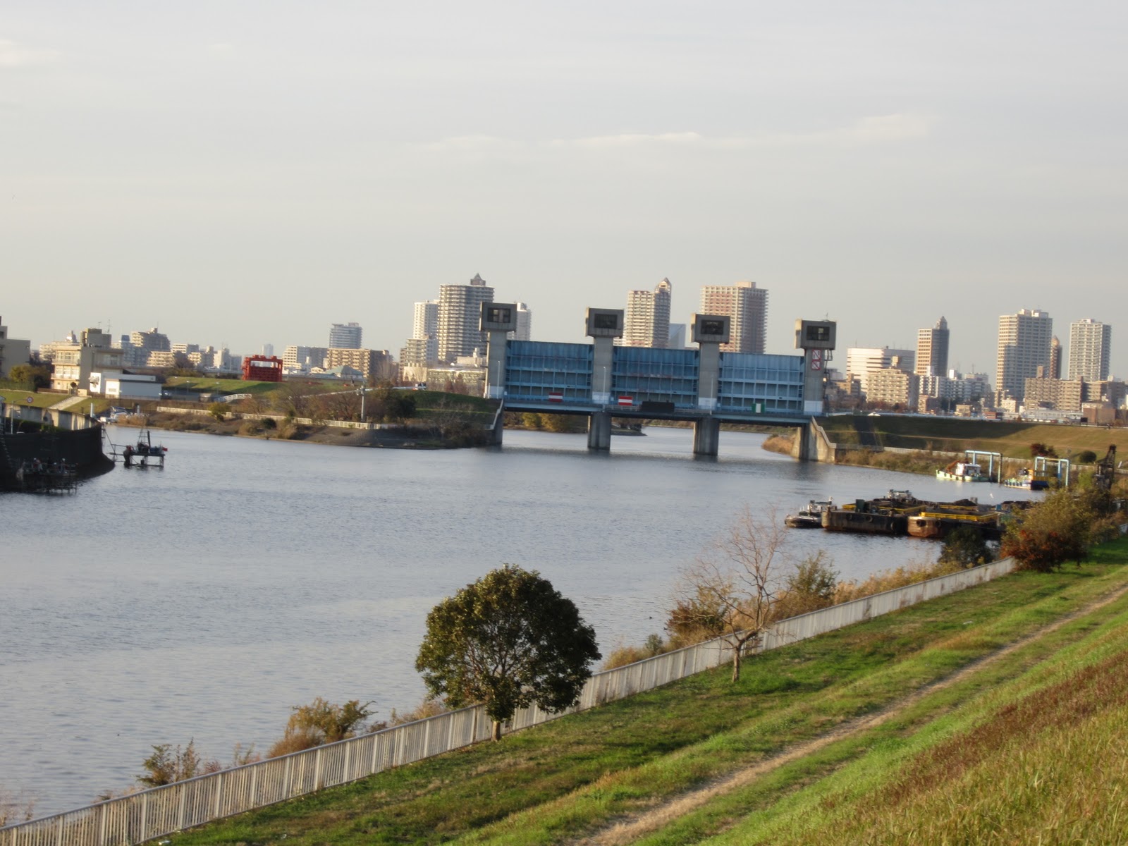
I walked a few kilometers on the bank before arriving at the separate point (of Arakawa River and Sumida River). I saw Sumida River in my left and Arakawa River in the right.


I met many cyclers and walkers in the road. Golf courses, baseball fields, cycling roads and other facilities for outdoor activities are developed in the riverfield.

The river(s) was wide at the separate point. Water flows slowly. It is about 21 kilometers from the sea.


Arakawa River originally flowed into Sumida River. The current Arakawa (lower part) was developed artificially in the early 20th century to prevent flood disasters.


A huge water gate was built to control the water volume flows into Sumida River.  A board shows information about the gate and water control. It also provides the bird-eye pictures of the river at normal time and heavy rain days.


I dropped in a museum where they showed the information about Arakawa River and disaster prevention. It was impressive that Tokyo’s major rivers including Sumida and Arakawa flow higher places than surrounding residential areas. They became raised bed rivers because of the soil carried by the rivers themselves.