Showing posts with label around Bay. Show all posts

2022-05-06

Kanda River Walk 2022 (4) Iidabashi-Sumida River, May 5, 2022


I had the 4th and final day of my Kanda River Walk in 2022. The course was from Iidabashi to Yanagibashi, where Kanda River flows into Sumida River.


The JR Chuo Line meets Kanda River at Iidabashi. The river and railroad go eastward together.

Similar scene was found at Suidobashi. (See the 2nd photo)


I moved to the Ochanomizu district. There are university hospitals as well as other academic institutes in the area.


A construction work was under way in the river. 

The subway crosses Kandagawa at Ochanomizu.


There remains a closed old station (old Mansei Station) at Mansei Bridge, which locate between Ochanomizu and Akihabara.


There are many electronics stores in the Akihabara area.


I had another 1km walk and arrived at Yanagibashi. Kanda River flows into Sumida River here.


There are many boats floating in the river. People enjoy cruising and dining with the boats. People also hire the boats for fishing.

******

It was 24km from Inokashira Park to Sumida River.

I found many changes since 2010, when I had a walk of the same course last time. The changes include: redevelopments of areas such as Shinjuku’s Yodobashi area, more local community activities including carp streamers displays, reconstruction of facilities in the riverside walks, flights of airplanes over central Tokyo area, which was not allowed 12 years ago, and many others.

It is interesting to see such changes.


2021-03-18

Tokyo International Airport under the COVID-19 pandemic: March 15, 2021


I visited Tokyo International Airport at Hanede.

More than one year has passed since the declaration of pandemic by the WHO.


More than 120 million cases have been confirmed and over 2.6 million people have been killed by the disease worldwide.

The vaccination started in some countries late last year, but the pandemic continues.


There were few people in the airport’s international terminal. (See also the top, the 2nd and the 3rd photos)

Most parts were empty.


Most planes were cancelled.


Parts of seats were banned to use.


There were operations of few plans in the day, but I saw no people around the departure gate.

There were limited number of planes in the parking lots. (See also the 4th photo)


There were few people in the adjacent railway station.

It may take some time before the situation turning better.


2018-06-10

Yamanote Line Walk (2) Hamamatsucho-Gotanda: June 2, 2018


I had the second day of my Yamanote Line walk. Today’s course was from JR Hamamatsucho station through Tamachi, Shinagawa, and Osaki to Gotanda.

JR Hamamatsucho station is not far from Tokyo Tower. It stands behind the buildings.

The World Trade Center, at the side of the station, was Japan’s tallest building between 1970 and 1971. It has business and commercial facilities.

Toshiba’s headquarter stands near Hamamatsucho.

I found house boats staying in a canal. They are for anglers.

The Yamanote Line runs quite near the sea around Hamamatsucho and Tamachi station. There are large and small canals running in the area.

A monorail line, which connects Hamamatsucho and Haneda airport runs over the canals. (See the top photo)

Huge apartment have been build in the last 2 decades.

New construction works are under way near Tamachi station.

The view of Tokyo Tower from this area was also impressive. (See the 2nd photo from the top)

There is a plan to build a new station of Yamanote Line between Tamachi and Shinagawa stations. It is expected to open in 2020.

Shinagawa is a station of not only Yamanote Line, but also Kehin Tohoku Line, Tokaido Line, Shinkansen bullet train and Keikyu Lines.

There was a shukuba station of Old Tokaido in the Edo era. The street remains in the area.

Yamanote Line and Tokaido Line (as well as Keihin Tohoku Line) separate in the place west of Shinagawa.

Yamanote Line crosses Meguro River near Osaki.

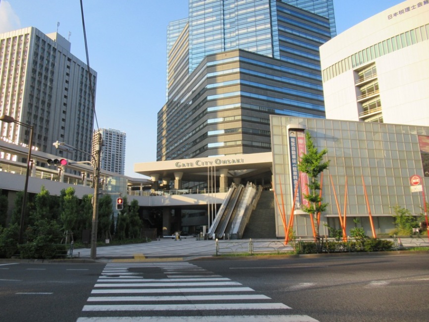
Osaki’s redevelopment was promoted after the 1980s. Osaki Gate City is one of the examples.

Many apartments and commercial buildings have been developed along the Meguro River. (See also the 3rd photo from the top)

Various redevelopment projects are promoted in Gotanda area now.

There are construction works under way in and around the JR station.

2017-12-05

Tatsumi @ Tokyo Bay waterfront areas: Dec. 5, 2017


I walked around Tatsumi, a part of the waterfront districts of Tokyo Port.

Many warehouses and logistics centers gather in the area

There is a junction of highways here. (See also the top photo)

Tatsumi Seaside Park lies along the highways.

I saw some leaves falling down. I also found yellow and red leaves.

The swimming competitions in the 2020 Tokyo Olympic and Paralympic Games will be held in the district.

A new facility, tentatively named “Olympics Aquatics Center,” is under construction.

The site is quite near the international swimming center. They cannot use current facility for the Olympic Games as the spaces for the audience are too small. (See als the 2nd photo from the top)

Canals run around the district.


2016-09-10

Keihin Canal and Seaside Park@ Oi area: September 4, 2016


There are many canals and seaside parks around the Tokyo Port.

I walked along Keihin Canal in the southern part of the port. Today’s walk was from Oi Central seaside Park to Shinagawa Seaside railway station.

The canal’s water was dirty decades ago, but it has become cleaner. I saw sea bass and other fish jumping and people enjoying fishing.

There are many warehouses along the canal.

The Tokyo Monorail Haneda Line runs along the canal.

People enjoyed BBQ in the Oi Central Seaside Park. 


Kids ware playing at the seaside.

I also found walkers and cyclists.


Shinagawa Seaside station area was developed about 20 years ago. Tens of office and residential buildings gather there.

All are summer-end scenes.