2011-10-29

Tokyo Bay Walk (2) Haneda-Oi: Oct. 29, 2011


I had the 2nd part of my Tokyo Bay Walk today. It was from Haneda to Oi.


Tokyo International Airport is built on an artificial island in Haneda. The airport faces the mouth of the Tamagawa River. The opposite side of the river is Kawasaki City, Kanagawa Prefecture.

I saw people enjoy fishing in the river. Airplanes landed every 1-3 minutes over the anglers.


We are allowed to walk only limited places around the airport. Highways as well as railways and monorail run around and under the airport. There are many office buildings and aviation related facilities, but few shops and houses here.


I moved to Morigasaki district. There are sewerage disposal plants (the west plant is in Omori Minami while the east plant is in Showa-jima island). The sewage from houses and factories in western Tokyo (about 25% of all Tokyo) is disposed here. The picture is taken by the Tokyo Metropolitan Government and is open to the public.


I walked along the canal side and passed many artificial islands. They included Showa-ji island, Keihin-jima island and Heiwa-jima island.


I found several water gates. I also saw many anglers and walkers. There stood hige warehouses along the canals.


Map: Haneda

2011-10-23

Meguro River Walk(1)Ikejiri-Gotanda: Oct 23, 2011


I had a walk along Meguro River from Ikejiri to Gotanda. The river runs western part of central Tokyo.


I often have weekend walks along Kitazawagawa and Karasuyamagawa walkways in Setagaya Ward (see previous post). The walkways were made along small rivers. Both rivers merge at Ikejiri and become Meguro River.


The river runs through business and residential areas. Buildings, apartments and other houses stand along the river.


The river is narrow at Ikejiri. There were various autumn flowers and butterflies flow along the river.
It turns into wide cement-protected river south of Ikejiri. The protection works were completed in the 1930s. Water increases as sewage flows into the river.


Aobadai (south of Ikejiri and west of Shibuya) is one of the richest residential areas in Tokyo. There were many high-quality shops and restaurants along the river. One boutique shop named itself “snobbish babies”. The dogs were also relaxed.


The river’s flow becomes slow at Nakameguro. The land is about 6 kilometers from the mouth of the river and seven meter high from the sea level. The river runs seven meter below the land here. It means the water stays in the same level with the sea.
The sea water comes upward when the sea is full. I saw the sea fishes and birds


I dropped in a small museum. It explained the history and the nature of the river. The staff also explained the water and sewage system of Tokyo. The information included:


- The water is supplied to Tokyo mainly from Tone River, Arakawa River and Tama River.
- Tokyo is dependent its water supply on Gunma and other Kanto prefectures.
- Tokyo’s sewage system is getting old. The cleanup level of wasted water (before its release) is lower than usual when it rains. (because the water volume increases and the sewage system cannot dispose all).

2011-10-21

Tamagawa River Walk (4) Fuchu-Tachikawa: Oct 16. 2011


I had the 4th part of Tamagawa River walk (see part 3). It was from Fuchu, or about 30 km point from the river’s mouth, to Tachikawa, 40 km point.


It was a nice autumn day. The river field was covered with silver grass and other autumn grasses. Huge residential complex and factories were built in some parts of the riversides.


There is a paved road for cyclists and walkers along the rover. The road is called Kaze-no-michi, which means a road where fresh air flows. I saw huge many cyclists, joggers and walkers.


There were camping sites, too. Families enjoyed BBQ parties.


I saw Mt. Fuji over the river. The line was beautiful.

2011-10-10

Showa Memorial Park@ Tachikawa : Oct. 10, 2011


It is autumn and today is the Sports Day (national holiday).


I visited Showa Memorial Park in Tachikawa city, about 30 km west from central Tokyo, to see cosmos blossom.


The Park opened in 1983 commemorating the 50th anniversary of Emperor Showa’s inauguration. The site was originally used by U.S. Air Force till the 1960s and returned to Japan.


The park is huge. It has large playing fields, ponds, flower fields and bird sanctuaries.


There are three cosmos flower fields in the park. The largest one has 2 million flowers. Pink, violet and white flowers were full open. Hundreds of visitors enjoy the blossom.


Yellow cosmos was planted in another field. Bees flied from a flower to others.


There are bases of Japan’s Self Defense Force and rescue operation organizations outside the park. Helicopters and small airplanes were parked. Many helicopters flew from here to Tohoku district after the Great East Japan Earthquake in March.

2011-10-08

Tokyo Bay Walk (1) Shinagawa-Oi: Oct. 8, 2011


Six of Tokyo’s 23 wards – Ota, Shinagawa, Minato, Chuo, Koto and Edogawa -- have seashore areas and they have developed Tokyo Port there. They have various types of terminals in the port.


I walked southern part of Tokyo Port -- from Shinagawa to Oi -- today.


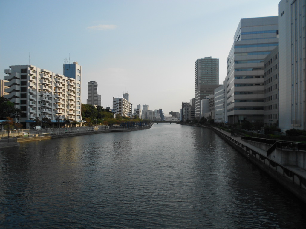
I left JR (Japan railway) Shinagawa station, crossed the Keihin Canal, and arrived at Shinagawa terminal. There are container terminals as well as automobile shipping places. They also have Tokyo Electric Co.’s power stations.


The area was very artificial. Only warehouses, distribution centers and other industrial facilities spread in the area. The roads are wide (so that trucks can move easily) and the industrial railways run in the area. I did not feel the atmosphere of daily life (of the people) there.


The lands are artificial made (by landfill after the Edo era). Artificial waterways ran through the areas.


I passed a bridge and moved into Oi Area. There are large container terminals in the area.


Japan’s 3 major sea line companies have their terminals here.


Tens of thousands of containers were piled in the yards. Huge crane machined boasted their existences.


Some of container ships are more than 300 meter long and carry nearly 10 thousands containers in each voyage. Cutting edge computer system is necessary to control millions of containers.


Container Tracks were waiting in lines to enter the terminals even in Saturday.


I attach a picture taken inside the terminal at another occasion in this blog post.


There are several natural parks in the area. Bird sanctuaries are there.

2011-10-02

Korean town @ Okubo: Oct 2, 2011


Tokyo has several foreigners’ towns. Okubo area has Tokyo's biggest Korean town. I visited theere.


Okubo area lies north of Shinjuku, Tokyo’s largest shopping and amusement area.


There are two main streets of Korean town – Shokuan-dori street and Okubo-dori street – and many small streets. About 70% (58 out of 85) of all food stores and restaurant at the two main streets were Korean (if my count is correct).


Most restaurants serve Korean BBQ. There are Korean food supermarkets, too. I saw girls made long queues at Korean-food takeout shops.

Video and CD shops are also popular. Korean actors and singers have became popular in the last decade in Japan.

Both Korean (1st -4th generations) and Japanese were there. I heard both Korean and Japanese languages when I walked the streets.


Narita: Oct.1, 2011


The name of Narita is known as a home town of the New Tokyo International Airport. But it has more than that.


The city hosts Narita-san Shinsho-ji, one of nation’s popular and important temples.


There are hundreds of restaurants and gift shops along the road from JR Narita railway station to the temple. Tens of restaurants serve unadon or eel rice bowl.


Visiting Narita-san became popular in the Edo era as it was only about 50 kilometers between Edo (Tokyo) and Narita and was easier than other famous shrines or temples (such as Ise Shrine) to visit. Temple town also developed.


Narita-san has a huge place. There are many buildings including the main building and towers in the area. There spread a nature-rich park behind the temple. Sculptures, stone monument and tombs spreads in the woods.


The temple was built in the 10th century and developed as one of the main temple of Shingon Buddhism.
Millions of people visit here in the new-year season.


Narita Airport is about five kilometers from the central city. The area is called Sanrizuka and Shibayama.


Strong resistance movement occurred when the government announced its plan to open a new airport in the mid 1960s. Far left extremists joined the movement and it took more than 10 years before the airport opened in 1978.


Sanrizuka was farming area and the royal family’s stock farm was there. Now, a memorial park keeps the Imperial farm’s history.


Airplanes fly over the houses in Sanrizuka.