2011-12-11
General Nogi’s house, around Aoyama: Dec. 11, 2011
Many Japanese watch TV program “Saka no ue no kumo” (A piece of cloud over a hill) on Sunday evening at this season. It was and is being broadcast in December in 2009, 2010 and 2011.
The program is based on a nationwide popular novel in the same title written by Shiba Ryotaro. The story focuses on Japan’s development and ways of lives in the Meiji period. Many heroes as well as ordinary people appear in the drama.
General Nogi Maresuke, who commanded the battle around Lshun in the Russo-Japanese War (1904-05), is one of the main figures. Nogi is also famous for his martyrdom after the death of Meiji Emperor.
I visited Nogi’s house. The house was converted into a public park and Meiji-style building is preserved. A horse stable also remains.
Several visitors were talking about Nogi and taking pictures.
A shrine was built in the neighboring place to commemorate Nogi. A shinto-style wedding was held.
The sword Nogi used for his suicide was displayed in a small museum.
I walked around Nogizaka-Aoyama areas and visited the gingko-tree street in Gaienmae. Leaves have turned yellow. Families were enjoying the color.
Winter is around the corner.
2011-12-10
Sumida River Walk (4) Toshima - Iwabuchi: Dec.10. 2011
I took the 4th and last part of my Sumida River walk. It was from Toshima in Kita ward (near Oji) to Iwabuchi, where Sumida River separates from Arakawa River. (See part 1, 2, and 3)
Toshima is about 10 minutes walk from JR Oji station. The river curves sharply here. Large apartments are built.
Highways run along Sumida River. Helicopters flied over the town because a SDF (Self Defense Force) base is in Oji area.
I found a monument of an old (early 20th century) wall. The area was repeatedly damaged by flood disasters and many river banks were built. The old wall is still used in some parts of Sumida River.
Construction works were carried out in many places to rebuild the riverbanks. Some works began after the Great East Japan Earthquake in March.
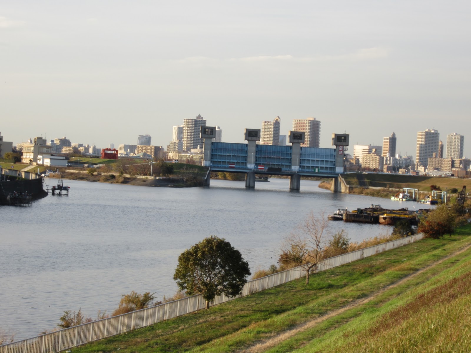
I walked a few kilometers on the bank before arriving at the separate point (of Arakawa River and Sumida River). I saw Sumida River in my left and Arakawa River in the right.
I met many cyclers and walkers in the road. Golf courses, baseball fields, cycling roads and other facilities for outdoor activities are developed in the riverfield.
The river(s) was wide at the separate point. Water flows slowly. It is about 21 kilometers from the sea.
Arakawa River originally flowed into Sumida River. The current Arakawa (lower part) was developed artificially in the early 20th century to prevent flood disasters.
A huge water gate was built to control the water volume flows into Sumida River. A board shows information about the gate and water control. It also provides the bird-eye pictures of the river at normal time and heavy rain days.
I dropped in a museum where they showed the information about Arakawa River and disaster prevention. It was impressive that Tokyo’s major rivers including Sumida and Arakawa flow higher places than surrounding residential areas. They became raised bed rivers because of the soil carried by the rivers themselves.
2011-11-28
Tokyo Bay Walk (4) Tsukiji-Arakawa River: Nov.26, 2011
I walked the western part of Tokyo Bay (in Tokyo) in my past three walks (see part 1, part 2, part 3). I walked north eastern part of the bay today.
The geography is complicated in the region as there are many artificial islands there. Some are old and some are new. The reclamation works began in the Edo period and continued more than 400 years. The lands have their histories.
>>1880 (early Meiji) sea line
Tsukiji – Tsukudajima Island – Ecchujima – Kiba – Toyo – Minamisuna – Higashisuna – Arakawa River – Kasai
-- The lands reclaimed in the Edo era include:
Hibiya, Tsukiji, Shinkawa, Tsukudajima Island, Ecchujima, Fukagawa, Kiba, Suzaki (Toyo), Sunamura (Minamisuna, Higashisuna), Kasai
-- 1930 (early Showa) sea line
Harumi – Toyosu –Shinonome – Tatsumi – Shinsuna – Arakawa River – Kasai
The last part of Sumida River lies between Tsukiji and Tsukishima, an artificial island developed in the Meiji era. There are modern apartments along the river. The riverside walkway is modern and beautiful. I saw many seagulls in the river.
Tsukudajima Island was developed in the Edo era. Traditional shops of tsukudani, or traditional seafood boiled in soy source, attracted visitors.
I found an old ship named “Meiji maru” displayed in the ground of Tokyo University of Marine Science and Technology.
Power cables run over the river. The lines of transmission towers were beautiful in the sunset.
2011-11-23
Sengawa River Walk (2):Nov.23, 2011
I walked along Sengewa River which flows in Setagaya ward (1st walk on June 6, 2010).
I walked southward from Seijo station.
The river flows through residential areas. Cherry trees are planted along the river. The leaves were turned red.
There gather TV and cinema studios in the area. Ultra man, a SF hero first appeared in the late 1960s, was made here. A cinema company Toho’s studio is along the river.
Many ducks were swimming in the river.
Meguro River Walk (2): Nov.20, 2011
I had the 2nd part of my Meguro River Walk (Part 1 on Oct. 23). It was from Gotanda to Tokyo Bay.
I arrived in Osaki district after about 20-minutes walk. The district was re-developed in the late 1990s. Modern apartments as well as office buildings and commercial complexes spread in the area. I saw many families enjoying their holidays in the parks and other public spaces along the river side.
There are many factories and other industrial facilities in Osaki and Shinagawa areas. There scatter many Sony buildings.
There emerged temples and shrines as I approached the sea. I crossed Old Tokaido street about 500 meters before the sea line.
Several Artificial islands were developed at Meguro River’s mouth area. They include the Tennoz Island. A police patrol boats moved through the canals.
2011-11-15
Tokyo Bay Walk (3) Shinagawa-Takeshiba: Nov. 12, 2011
I took the 3rd part of my Tokyo Bay walk. It was from Shinagawa to Takeshiba Pier.
The area has many faces. There are container and passenger terminals in the seaside. There are office buildings and commercial facilities as well as apartments. Canals run in the earth and highways and monorail are over the ground.
I walked the passage along a canal near JR Shinagawa station. The water was calm and the seagulls looked relaxed.
I saw a sewerage disposal plant near Shinagawa station. It reminded me of the huge volume of Tokyo’s waste and of the importance of disposal system.
The Rainbow Bridge connects Shibaura and Odaiba districts. Cars and trains move round and climb the road or the rail before crossing the bridge. The scene has already become one of the symbolic views of Tokyo.
I moved Shibaura terminal. There were warehouses in the seafront area.
An old ship was displayed in a road (walkway). The ship was used in the Taisho Period (1910-25) for land reclamation work. A monorail car passed over the sea when I was arrived there.
I moved forward and arrived in Hinode terminal. It is mainly used for passenger ships. I sawa many tourists gathering here to enjoy Tokyo Bay cruising. Many buses were waiting their guest returning from the cruise.
I moved up to Takeshiba Pier. Another passenger lines, including the lines to/from Ogasawara and other located islands, leave and arrive here. The terrace was floored with timbers and wea well decorated.
* If you walk the seafront line of Tokyo Bay clockwise from south, you will pass following places.
(1)Haneda Airport (2)Minami Omori (3)Showa-jima Island (4)Keihin-jima Island (5)Oi container terminal (6)Shinagawa container terminal (7)Shibaura terminai (8)Hinode terminal (9)Takeshiba pier.
Then, you will arrive at Tsukiji or the mouth of Sumida River. They are the west part of the bay in Tokyo territory (Tokyo Bay is surrounded also by Kanagawa and Chiba Prefectures).
Today’s walk was from point (6) to (9).
2011-11-08
Suzhou (off off Tokyo): Nov. 6-8, 2011
I visited Suzhou, Jiangsu Province, China. It locates about 100 kilometers west from Shanghai.
Big and small canals run through the city.
I had a walk along Shantang Street, one of the most famous old streets in the city, in the early morning (it was unfortunately rainy). A canal runs along the street.
There were open-air markets. Fishes were sold in basins or on papers. Famous Shanghai hairy crab was gathered in a net and sold. Vegetables, fruits and sweets were also sold. Children walked to their schools. It was active and noisy.
The water moves slowly in the canal. The walls of the houses along the canal were painted white. A boat was moving along the canal to pick up leaves and rubbishes.
Suzhou is also famous for its gardens. The classical gardens of Suzhou are registered as a world heritage.
I visited Humble Administrator’s Garden and Lion Grove Garden.
Humble Administrator’s Garden is the largest in the city. The combination of ponds, trees, rocks, and buildings was beautiful and impressive.
Lion Grove Garden was decorated with many rocks in unique shapes.
There were many Chinese tourists in both gardens.
There are new industrial zones developing outside the city. The Jiangsu Province government has been successful in inviting foreign companies and in developing industries. The city is rapidly changing.
2011-10-29
Tokyo Bay Walk (2) Haneda-Oi: Oct. 29, 2011
I had the 2nd part of my Tokyo Bay Walk today. It was from Haneda to Oi.
Tokyo International Airport is built on an artificial island in Haneda. The airport faces the mouth of the Tamagawa River. The opposite side of the river is Kawasaki City, Kanagawa Prefecture.
I saw people enjoy fishing in the river. Airplanes landed every 1-3 minutes over the anglers.
We are allowed to walk only limited places around the airport. Highways as well as railways and monorail run around and under the airport. There are many office buildings and aviation related facilities, but few shops and houses here.
I moved to Morigasaki district. There are sewerage disposal plants (the west plant is in Omori Minami while the east plant is in Showa-jima island). The sewage from houses and factories in western Tokyo (about 25% of all Tokyo) is disposed here. The picture is taken by the Tokyo Metropolitan Government and is open to the public.
I walked along the canal side and passed many artificial islands. They included Showa-ji island, Keihin-jima island and Heiwa-jima island.
I found several water gates. I also saw many anglers and walkers. There stood hige warehouses along the canals.
Map: Haneda
2011-10-23
Meguro River Walk(1)Ikejiri-Gotanda: Oct 23, 2011
I had a walk along Meguro River from Ikejiri to Gotanda. The river runs western part of central Tokyo.
I often have weekend walks along Kitazawagawa and Karasuyamagawa walkways in Setagaya Ward (see previous post). The walkways were made along small rivers. Both rivers merge at Ikejiri and become Meguro River.
The river runs through business and residential areas. Buildings, apartments and other houses stand along the river.
The river is narrow at Ikejiri. There were various autumn flowers and butterflies flow along the river.
It turns into wide cement-protected river south of Ikejiri. The protection works were completed in the 1930s. Water increases as sewage flows into the river.
Aobadai (south of Ikejiri and west of Shibuya) is one of the richest residential areas in Tokyo. There were many high-quality shops and restaurants along the river. One boutique shop named itself “snobbish babies”. The dogs were also relaxed.
The river’s flow becomes slow at Nakameguro. The land is about 6 kilometers from the mouth of the river and seven meter high from the sea level. The river runs seven meter below the land here. It means the water stays in the same level with the sea.
The sea water comes upward when the sea is full. I saw the sea fishes and birds
I dropped in a small museum. It explained the history and the nature of the river. The staff also explained the water and sewage system of Tokyo. The information included:
- The water is supplied to Tokyo mainly from Tone River, Arakawa River and Tama River.
- Tokyo is dependent its water supply on Gunma and other Kanto prefectures.
- Tokyo’s sewage system is getting old. The cleanup level of wasted water (before its release) is lower than usual when it rains. (because the water volume increases and the sewage system cannot dispose all).
2011-10-21
Tamagawa River Walk (4) Fuchu-Tachikawa: Oct 16. 2011
I had the 4th part of Tamagawa River walk (see part 3). It was from Fuchu, or about 30 km point from the river’s mouth, to Tachikawa, 40 km point.
It was a nice autumn day. The river field was covered with silver grass and other autumn grasses. Huge residential complex and factories were built in some parts of the riversides.
There is a paved road for cyclists and walkers along the rover. The road is called Kaze-no-michi, which means a road where fresh air flows. I saw huge many cyclists, joggers and walkers.
There were camping sites, too. Families enjoyed BBQ parties.
I saw Mt. Fuji over the river. The line was beautiful.
Subscribe to:
Posts (Atom)