2017-08-01

Kofun (ancient mounted tombs) and towns of Sakai: July 29, 2017 (off Tokyo)


Kofun is a unique tomb of ancient Japan. The mounted tombs were built in the 4th to 6th century in the Kinki region - Osaka, Nara Kyoto and neighboring areas –and other parts of the country.

Many tombs gather in the southern parts of Osaka. The tombs in Mozu, in Sakai City, and the tombs in Furuichi, in Fujiidera and Habikino citires, are especially famous. The largest kofun is the tomb of Emperor in Mozu tombs in Sakai City, southern neighbor of Osaka City.

I visited Sakai to see the tombs and the towns.

I first went up the observation room of the City Hall. It is 80 meters high.

Many kofun in the area was made in the style of “square at the front and rounded in the rear.” We can recognize the shape when we see it from 300 meters high or more (in the planes).

The shapes were not clear from the observation room. The looked like small woods. The picture is emperor Nitoku's tomb. (See also the top photo). 

Still, it was very impressive that many kofun scattered in the houses and buildings in the city. The photo is Emperor Hanzei's tomb.

There are 44 kofun preserved in the Mozu tombs.
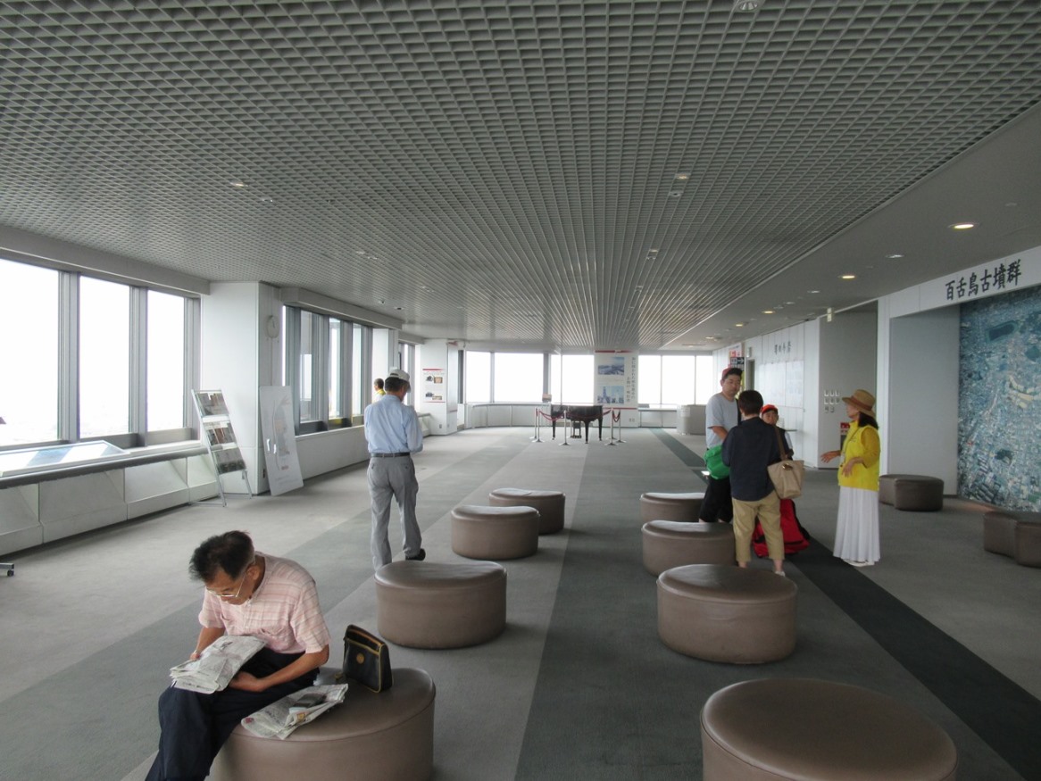
There were volunteer citizens who provide information on Sakai and kofun. I had a talk with one of them for nearly one hour.

I walked around the city.

Emperor Nintoku’s kofun is 486 meters length and is surrounded by triple moats.

It is prohibited to enter the kofun which are believed to be ancient emperors’ tombs. A shrine stands in front of Emperor Nintoku’s kofun. (See the third photo from the top) 


There are walking paths arranged around the tomb. I saw citizens walking in the hot day.

I also visited Emperor Richu’s kofun.

It is the third largest ones in Japan.

I found news houses were being built around the tomb.

I also visited smaller kofun –Itasuke kofun and Goryouama kofun. Hundreds of houses stand around the tombs.

There was a plan to develop houses in the Itasuke kofun decades ago. The plan was stopped by the citizens7 opposition. The parts of a bridge, which was planned to use for house development, remain there.

Sakai is famous not only for its ancient history but also for its medieval and modern histories.

Sakai was the country’s largest free port city in the 16th century. Japan’s most advanced gun factories were built here. The technology was later used to develop metal products such as knives and bicycles.

Now, bile sharing services are available in Sakai.


2017-07-16

Ginza Six @ Ginza: July 12, 2017


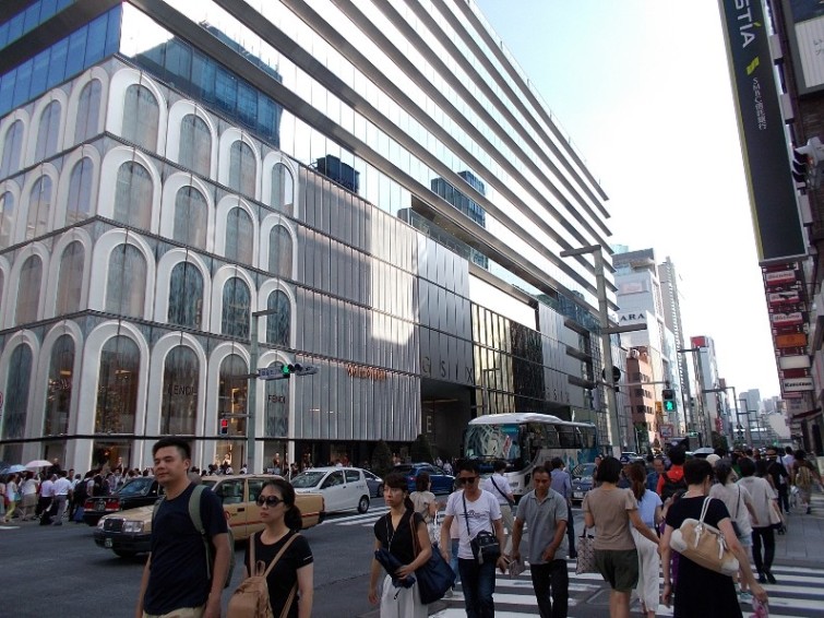
A new landmark, Ginza Six, opened in Ginza in April. It is the largest shopping complex in the area. It has a tourist center and other facilities for foreign tourists.

There are various brand shops in it.

There is a bus terminal outside of the building.

A tourist center is open there.

They also have a Noh (Japanese traditional performing art) theater inside the building.

There are many foreign and Japanese visitors. coming in and leaving the complex.

Another landmark Uniqlo building is at the opposite side of the complex.


Hozuki Market@ Asakusa: July 10, 2017


It is summer. 

The weather has been irregular in Japan this month. While we have had heavy rains in Kyushu and in other some parts of Japan, we have had very hot days in Tokyo.

I visited Asakusa to enjoy Hozuki (Chinese lantern plant) market.

The area was crowded with many foreign tourists.

Visitors were taking pictures at Kaminari (Thunder) Gate.

They enjoyed walking Nakamise shopping street.

The sunshine was strong and it was so hot. Some girls are in the traditional yukata costume.


2017-06-18

Rainy Season Starts: June 18, 2017


Rainy season started in Tokyo.

It rained all the afternoon today.

I had a short walk in Setagaya ward, western Tokyo.

At Gotokuji Temple (it is also called the cat temple by some foreign tourists as it has many cat dolls), visitors were talking under the tower with their umbrellas open. (See the top photo)


The, they walked around the garden.

I found various season’s flowers in the walking paths. They included hydrangea and Japanese kerria. (See also the 2nd photo from the top)

The green is getting deeper as rains give flesh water for the trees and the grasses.

The rainy season will continue several weeks.


2017-05-18

Iwaizumi Town, Iwate Prefecture (off Tokyo) : May 13-14, 2017


Iwaizumi Town is located about two hours’ drive east of Morioka City, the capital of Iwate Prefecture, northern Japan. The town was seriously hit by the typhoon disasters last summer.

I visited there to join some volunteer activities.

The rivers in the town overflowed in many places and washed away the houses, roads and bridges.
They also had landslides of the mountains.

Nine months have passed since then. I found the damages remained in many places.

The houses at the riversides were destroyed; they are left as they were. The electric poll fell on the house. (See also the top photo)

Soil, sands and rocks flew into the houses. It is necessary to wipe out the soil and to take out the pieces of broken furniture before restoring or disposing the buildings. They expect volunteer workers to help such jobs.

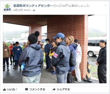
I, as well as other members of my group, visited the Iwaizumi Volunteer Center in the morning of May 14 and got explanations of the works of the day.

There also were other volunteers including a group of foreigners.

We moved to a house in the mountainous region, which was washed heavily by a landslide. (See the 2nd photos from the top)


I found the floors were covered with rock and sands. Broken cabinets and tables, food boxes and other materials scattered in the rooms.

We worked about five hours to take materials out of the house, to segregate the wastes into several categories such as metals, glasses and burnable wastes, and to put some of the wastes into garbage packs.

The family members of the house were there and checked if there were some materials to be kept.

It is reported that total 15000 volunteer workers have been engaged in the activities in Iwaizumi after the typhoon disasters. The works have been completed at more than 700 houses.

Excavators and other construction machines are everywhere in the town.

The Facebook page of the Iwaizumi Volunteer Center is found here.

They took the photos when the day's activities (explaining the activities to the participants) started in the morning. The photos were uploaded on their pages in the afternoon. A quick job!!

The left photo is from the center's Facebook page.


Iwaizumi's nature is beautiful. We experiences walking in the mountains and picking up mountain herbs.


The town is trying to activate the communities with tourism and other businesses like other towns and villages do in Japan.


On the way from Morioka to Iwaizumi, we found the colonies of skunk cabbage. It was beautiful.

Not a few schools in the region were closed.in the last decades Some of them have converted into commercial facilities. 


See also 
Save Iwate @ Morioka, Sanriku Coast (May, 2014)
3 years after the quake @ Iwate (May, 2014)
Four and half years after the quake (Oct.- Nov. 2015)
Autumn scenes @ Iwate (Oct.-Nov., 2015) 


2017-05-12

Nakasendo Walk (26) Fushimi(50/69)-Ota(51/69)- Unuma: May 7, 2017


Nakasendo cross the Kiso River between Fushimi, which lies in the eastern side of the river, and Ota, in the western side. It is regarded as one of the hardest places to travel in all Nakasendo in the Edo era.


I walked through Mitake Town and Kani City before arriving at the Ota Bridge. It took only a few minutes by foot to cross the river. People needed to use boats in the Edo era.

I entered Minogamo City when I crossed the river. I had another short walk and moved into Ota shukuba station, the 51th from Nihonbashi. Various old buildings remain here.

I visited an old inn called “Komatsuya,” which is now used as a rest place.

Ota’s second prestigious inn (waki-honjin) was originally built in the 1760s or about 240 years ago. A part of the building, which was constructed about 150 years ago, is open to the public.

The rooms remain as they were. There is a plant in the garden gifted by a leading politician Taisuke Itagaki in the early Meiji period. There are various histories connected with the shukuba station.

The Kiso River flows along the shukuba station.

I visited a visitor’s center. They have an exhibition space of the local history. I also found farmers markets both inside and outside of the building. (See the 3rd photo from the top)

They held a drawing competition in the city on the day I visited there. I saw many people drawing pictures sitting on the roads, benches and other places. (See also the 4th photo from the top)

I moved westwards and found that Nakasendo went on the banks of the Kiso River.

This part of Kiso River is called Nihon Rhein (the Japan Rhein). 


The road is named the “Japan Rhein Romantic Street.” I saw many cyclists on the road. (See also the top photo)

It had a pleasant walk.

The road goes into Sakahogi Town. The town hosts a factory of Mitsubishi Motor’s Pajero.
I walked into Unuma City, where Unuma shukuba station locates. The scenes of the river were beautiful. (See also the 2nd photo from the top)