2023-05-03

Koshu Kaido Walk (7) Yose (14/44)-Uenohara(17/44): May 3, 2023


I resumed my Koshu Kaido Walk after an interval of about 10 years.

I walked the first part of the Koshu Kaido, which linked Tokyo’s Nihonbashi and Shimosuwa (in Nagano Prefecture), in the early 2010s. Total distance is about 210 km. It goes through Tokyo, Kanagawa, Yamanashi and Nagano prefectures.

Most parts I walked ten years ago was in Tokyo Prefecture and in flat places.


Today’s walk was in Kanagawa and Yamanashi prefectures.

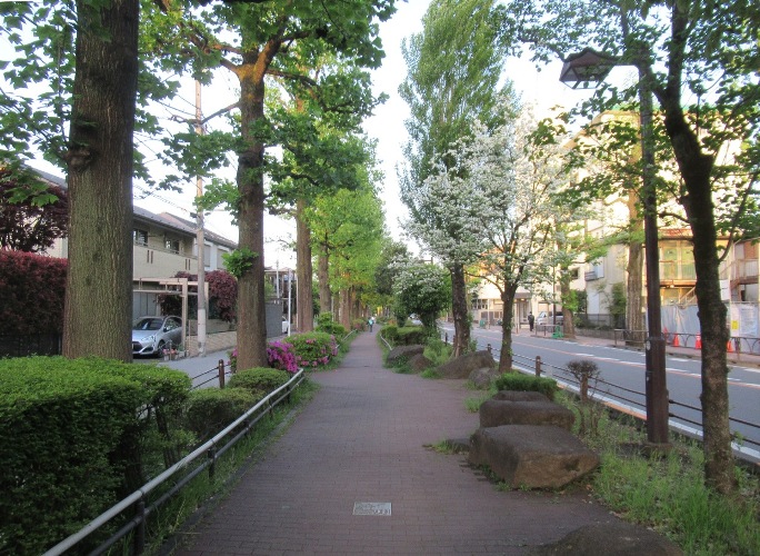
The Koshu Kaido goes westward along Lake Sagami (Sagamiko) in this area. (See also the top photo)

Lake Sagami is an artificial lake developed in 1947 with the completion of Sagami Dam on Sagami River.


It also should be remarked that the Koshu Kaido goes through mountainous in today’s course. 

The photo was taken between Yose, the14th shukuba station and today's start, and Yoshino, the 15th station. 


I started today’s walk from JR Sagamiko station. Yose, the 14th shukuba station located in this area.

I saw Lake Sagami just below the Koshu Kaido.


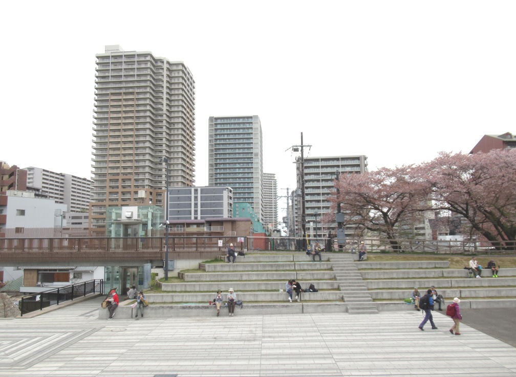
The Koshu Kaido was converted to Route 20 in some part. The Koshu Kaido, the JR Chuo Line and the Chuo Expressway run parallel in some areas. (see also the 3rd photo)

The roads runs along the lake in some parts.


Walking the mountainous road about 4km, I arrived at Yoshino, the 15th shukuba station.

There is a monument of the main guest house in the Edo.


An traditional house was preserved as a museum today.


The scene of the lake from the house was beautiful. There used to flow narrower river in the Edo era.


I moved westward and arrived at Fujino area. The area is famous for its yuzu (small citrus fruit) and cultural activities.

Many artworks are displayed in the towns. These birds are located at the side of Benten Bridge. (See also the 2nd photo. It is a scene of Lake Sagami from the bridge).


I arrived in Sekino, the 15th shukuba station. Some monuments remain.


I walked westward and arrived at the border between Kanagawa and Yamanashi prefectures. There is a bridge (The Sakaigawa Bridge) at the side od the border. This is a scene of Lake Sagami from the bridge.


I moved in Uenohara City in Yamanashi Prefecture, I saw Suwa shrine and other monuments before arriving at Uenohara shukuba, the 17th station.


I walked down steep road to Uenohara railway station (It is a river-terrace landscape). Lake Sagami was behind.


2023-04-29

Flesh green: April 12-22, 2023


The season is turning from spring to early summer.

The air is getting hotter and flesh green is growing day by day.


New leaves of tulip trees opened in the early April in a walking path in Setagaya City. They grow rapidly.


Flesh-green leaves moved in the wind at the ruin of Setagaya Castle.


Maple trees now have new leaves in the Gotokuji Temple.


Various early summer flowers began to open.

The azalea flowers were fully open in the 2nd week of April in the Hanegi Park in Setagaya City.

Azalea flowers used to fully open in the late April. Now the peak is earlier by a few weeks.


The double-flowered cherry tree had pink flowers


Omihachiman: April 5, 2023 (Off Tokyo)


I dropped in Omihachiman City during my Nakasendo walk.

The city locates on the east coast of Lake Biwa.

Toyotomi Hidetsugu, young brother of Toyotomi Hideyoshi in the late 16th century, built the town as well as a castle. Many historical buildings still remain.


Many artificial rivers have been developed in the historical area.

Tourist bouts went up and down.

The cherry was fully open. (See the top and 2nd photos)


There stands “Himure Hachiman Shrine” in the area.

A legend says that the shrine has 2000-year history.


The traditional buildings remain in the Shinmachi street.


The city includes Azuchi area, where the ruin of Azuchi Castle remain. Azuchi Castle was developed by Oda Nobunaga, the ruler of Japan between 1570s (before Toyotomi Hideyoshi). The photo was taken in May, 2019.


2023-04-05

Nakasendo Walk (34) Yasu-Kusatsu (Arriving the goal): April 5, 2023 (off Tokyo)


I completed my Nakasendo walk today when I arrived at Kusatsu, the 68th shukuba station.

I started my Nakasendo walk in October 2012; used total 34 days to walk from Nihonbashi in Tokyo to Kusatsu in Shiga Prefecture. As for the walk from Kusatsu to Kyoto, I finished it in my Tokaido walk in May 2015.


It took more than 10 years to finish my Nakasendo walk. I had to The stop walking for more than three years from 2020 to 2022 due to the Covid-19 pandemic. 

It is very impressive to finish walking of about 520 kilometers.


Today’s walk started from Yasu City. A monument of Nakasendo stands at the side of elementary school.


I passed Yasu River and entered into Moriyama City.


An old sake brewery called “Uno-ya” is preserved near the ruin of honjin (main inn of Moriyama shukuba station). It is a birthplace of former Japanese Prime Minister Sosuke Uno (served as PM in 1989). (See also the 4th photo)


I moved forward and found a milestone called ichiri-zuka in Imajuku. It is the 128th milestone from Nihonbashi in Tokyo. As milestones were built in every (about) 4 kilometers, Imajuku’s one is about 510 kilometer from Tokyo.


I passed Ritto Town and moved into Kusatsu City. 


Nakasendo has been converted into a shopping street around Kusatsu shukuba station.


Naskasendo and Tokaido meet in Kusatsu shukuba station. (See also the 2nd photo)


The main inn (honjin) is preserved as it was in the Edo period. (See also the 3rd photo)


It was my first visit to Kusatsu since 2015, when I stayed here during my Tokaido walk. I was surprised with the changes of the towns.

Number of skyscrapers have been built around the shukuba station (and around the railway station, which is quite near from shukuba station). 


I found several high-rise apartments behind honjin.

The shopping street on Nakasendo has well been renovated.


The Kusatsu River used to be a ceiling river. Tunnels were made under the river move between both sides of the river.

An artificial river was developed in the 21th century and the water stopped running in the old ceiling river.


The site of former river was a grassland in 2015 when I visited here last time. Now it is a public park. (See also the top photo)


It was more than 400 years ago when Nakasendo was developed by Tokugawa Ieyasu. It continues changing now. The left photo is a merging point of Nakasendo and Tokaido taken from a park developed on the former ceiling river. 


2023-04-04

Nakasendo Walk(33) Gokasho-Musa(66/69)-Yasu: April 4, 2023


I started today’s walk from Gokasho, about three kilimeters southwest from Echigawa shukuba station. A village developed along Nakasendo in the Edo era. Gokasho is now in Higashiomi City.

Gokasho is famous as it produced many famous merchants. 


Old merchants’ houses remain along Nakasendo.

Houses with straw‐thatched roofs also remain.


There stands a statue of a merchant at the southwest side of Gokasho. He carries a pole on his shoulder. It is a typical appearance of the Edo period’s merchant.
 (See also the top photo)


I continued walking and moved into Omihachiman city. There are houses, agricultural fields as well as factories along Nakasendo. Cherry blossom was beautiful in many places.


I arrived Musa, the 67th station from Tokyo. It is in Omihachiman City. This place also produced famous merchants.

Some parts – the main gate and walls -- of the main guest house (honjin) as well as other traditional buildings remain here.


Wheat fields spread along Nakasendo. I found Shinkansen bullet train running over the field. (see the 2nd photo)


I passed the Hino River and enjoyed the cherry blossom on the riverbanks.


I moved in Ryuo Town. There are many spots relating to Minamoto Yoshitsune, a tragic hero in the late 11th century. He had his coming-of-age ceremony in Kagami Shrine and neighboring places.


He killed the last leaders of Heike family, the rival of Yoshitsune’s family Genji, in the place.


Nakasendo is converted into National Route 8 in some places. There are many big factories along National Route 8.


I finished today’s walk at Yasu City. It is about three km before Moriyama, the 67th shukuba station.