2018-06-12

Nikko Kaido Walk (2) Senju-Soka: June 4, 2018


I took the second part of my Nikko Kaido Walk. 

It was from Senju, the 1st shukuba station to Soka, the 3rd.

I started today’s walk from Kitasenju railway station. Old Senju shukuba is a bloc from the railway station. Old Nikko Kaido is now a shopping street.

Various monuments remain.

Local people are eager to reserve Senju’s tradition and history. There is a guest house for visitors there.

Passing Senju shukuba, I arrived Arakawa River. It is an artificial river developed in the in the 1910s to prevent flood disaster.

Nikko Kaido goes northward through Adachi City (Ward)There spread residential areas.

There are many apartment complexes in the area. They were developed 40-60 years ago when Japan was in the high-growth period. Most of them are old.

I stopped at Takenozuka. There are apartment complexes in front of the railway station. New commercial streets are developed in the place further from the station.

I walked northward and entered into Soka City in Saitama Prefecture. 

There is a small river called Kenaga River between Tokyo and Saitama.

Soka is famous for its rice crackers. There are some factories and stores along Nikko Kaido.

Many people commute to Tokyo from Soka.


Mt. Takao: June 3 and 9, 2018

I sometimes visit Mt. Takao, which stands in the western suburb of Tokyo. It takes about an hour by train from central Tokyo.


I visited there two consecutive weekends.


I found many hikers at the foot of the mountain. There are several routs to climb. I took different ways on the two different days.

I climbed the main rout on June 3. Many parts of the rout are paved with stones.

The green is getting deeper day by day in this season. (see the 2nd photo from the top)

There are many cedar trees at the side of the mountain.

There is a suspension bridge in the mountain (See the 3rd photo from the top). 
Big cedar trees stand along the route.


I took another rout on June 9.

I found the road covered with the roots of the trees in some parts. (See the top photo)


Mt. Takao is 599 meter high.

I had good exercises.


2018-06-10

Yamanote Line Walk (2) Hamamatsucho-Gotanda: June 2, 2018


I had the second day of my Yamanote Line walk. Today’s course was from JR Hamamatsucho station through Tamachi, Shinagawa, and Osaki to Gotanda.

JR Hamamatsucho station is not far from Tokyo Tower. It stands behind the buildings.

The World Trade Center, at the side of the station, was Japan’s tallest building between 1970 and 1971. It has business and commercial facilities.

Toshiba’s headquarter stands near Hamamatsucho.

I found house boats staying in a canal. They are for anglers.

The Yamanote Line runs quite near the sea around Hamamatsucho and Tamachi station. There are large and small canals running in the area.

A monorail line, which connects Hamamatsucho and Haneda airport runs over the canals. (See the top photo)

Huge apartment have been build in the last 2 decades.

New construction works are under way near Tamachi station.

The view of Tokyo Tower from this area was also impressive. (See the 2nd photo from the top)

There is a plan to build a new station of Yamanote Line between Tamachi and Shinagawa stations. It is expected to open in 2020.

Shinagawa is a station of not only Yamanote Line, but also Kehin Tohoku Line, Tokaido Line, Shinkansen bullet train and Keikyu Lines.

There was a shukuba station of Old Tokaido in the Edo era. The street remains in the area.

Yamanote Line and Tokaido Line (as well as Keihin Tohoku Line) separate in the place west of Shinagawa.

Yamanote Line crosses Meguro River near Osaki.

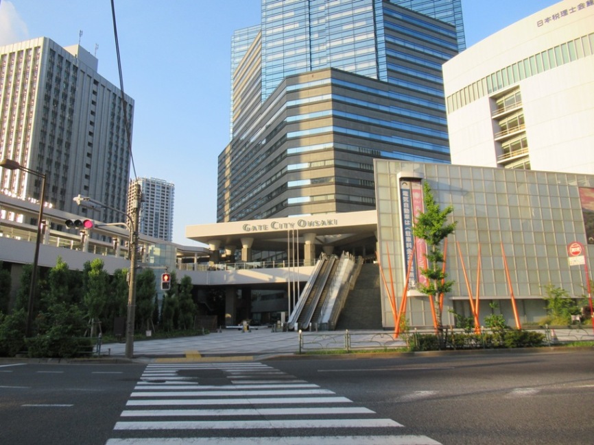
Osaki’s redevelopment was promoted after the 1980s. Osaki Gate City is one of the examples.

Many apartments and commercial buildings have been developed along the Meguro River. (See also the 3rd photo from the top)

Various redevelopment projects are promoted in Gotanda area now.

There are construction works under way in and around the JR station.

2018-05-31

Yamanote Line Walk (1)Tokyo- Hamamatsucho: May 30, 2018

JR Yamanote Line is a loop line which runs in the central part of Tokyo.

The total length is about 30km with 29 stations. It usually takes 61 minutes for a round, which means average two minutes for moving to next station.


As a resident of Tokyo, I very often walk around Yamanote Line stations. The scenes look different when I walk along the line.

Furthermore, the changes in Tokyo are so rapid. So, I can expect many findings from my Yamanote Line walks.


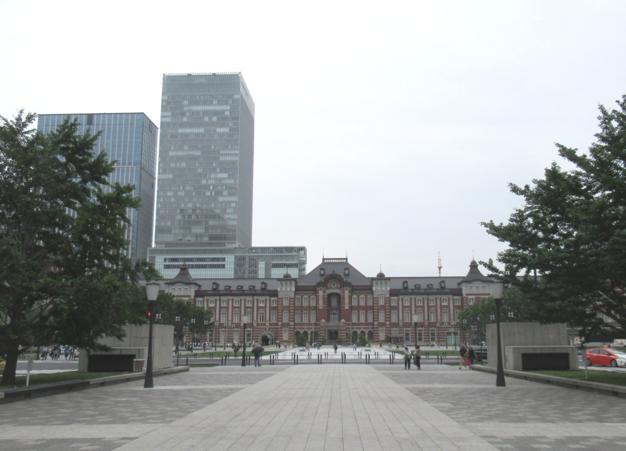
I started my walk from Tokyo station, the main station of the metropolis. (See also the top photo )


Various local and long-distance lines, including Shinkansen bullet train, start from the station.

The Tokyo station building was first built in 1914. After experiences serious damages during the World War 2, it was restored, keeping the original form, in 2012.

The road which connects Tokyo Station and the Imperial palace is called Miyuki Dori St.


There are many skyscrapers, including Marunouchi Building, around the station.

Japan Post Building, which locates at the side of the station, has a rooftop garden. The scene is beautiful, I found.

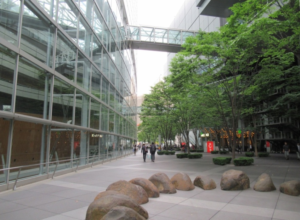
Tokyo International Forum lies between Tokyo and Yurakucho stations. Its ship-shaped glass building is famous.

Ginza, Tokyo’s most prestigious shopping area, lies in the east of Yurakucho station.

There are many restaurants under the elevated railways between Yurakucho and Shnbashi stations. (See also the 4th photo from the top)

Tokyo Midtown Hibaya, the city's new landmark which opened in March, 2018, also locates in the area. The statue of Godzilla stands in front of the tower. (See also the 2nd photo)


Shinbashi station is known as one of landmarks of Japan’s railroads as the nation’s railway operations started in 1872 between Shinbashi and Yokohama. There is an old locomotive in front of the station.

The areas around Shinbashi station were used as a cargo terminal until the 1980s. The areas were redeveloped after the 1980s. Now, there are many office buildings and apartment houses.

We can see a wide view of various trains – those of Yamanote Line, Keihin-Tohoku Line, Tokaido Line, Shinkansen and others -- running in the area between Shinbashi and Hamamatsucho station.

Tokyo is entering into the rainy season. It began to rain and I stopped today’s walk at Hamamatsucho.


2018-05-29

Ome Kaido Walk (1) Shinjuku-Ogikubo: May 28, 2018

Major five roads of the Edo period – Tokaido, Nakasendo, KOshu Kaido, Nikko Kaido and Oshu Kaido -- are widely known, but there were other important roads in pre-modern Japan. Some of them were called waki-kaido, or secondly major roads.

Many roads have been converted into important national and local roads.

I had a walk along Ome Kaido, which connected Shinjuku and Kofu, Yamanashi Prefecture, through Ome City, western Tokyo. It had nine shukuba stations.

Today’s walk was from Shinjuku to Ogikubo.

Shinjuku is always busy. JR as well as private lines and subway lines use Shinjuku as their terminals. It is the busiest station in Japan. Many skyscrapers stand in the west of the stations.

There are many construction sites.

I found historical photos of Shinjuku on the protection walls of a construction site.

Ome Kaido cross Kanda River and enters into Nakano Ward (City) from Shinjuku Ward. The bridge is called Yodobashi

Current Ome Kaido is crowded with cars. There are shops, restaurants and apartment houses at the sides of the road. Subway Marunouchi Line runs under Ome Kaido between Shinjuku and Ogikubo.

I passed Nakano Sakaue station. The shukuba station of Nakano existed here. There is no historical buildings or monuments remain.

Then, I passed Nabeya Yokocho near subway Shin-Nakano station.

Sanshi-no-mori park was developed in the place where they have had a research center of silk worms.

I moved westward to Asagaya area.

There are lines of gingko trees at the sides of the road around here.

Ome Kaido meets JR Chuo line at Ogikubo.

Today’s walk was about 8 kilometers. There are eight subway stations between Shinjuku and Ogikubo.